Procurement risk,
seen before harvest.
We monitor supplier fields from space to give food buyers up to 8 weeks of lead time on crop stress, floods, and vigor drops. Radical honesty on data validity. Zero agronomic prescriptions.
Global Paddy Network
Sacramento Valley, California • 14 Fields Monitored
Observational Only. Zero agronomic prescriptions.
Why Acreon Wins
We don't sell 95% accuracy myths. We sell truth, context, and lead-time confidence for food buyers.
Radical Honesty
If clouds block the view, we explicitly say "can't see right now." Every analytic shows capture date and a valid pixel %. No false confidence.
Actionable Lead Time
Auto-detect vigor drops versus baselines to give you 3–8 weeks of early warning. Stop reacting to harvest shortfalls.
Ground-Truth Calibrated
Close the loop. Send scouts to flagged anomaly zones. Their field observations directly calibrate our portfolio risk models.
Vigor Trajectories &
Photosynthetic Health
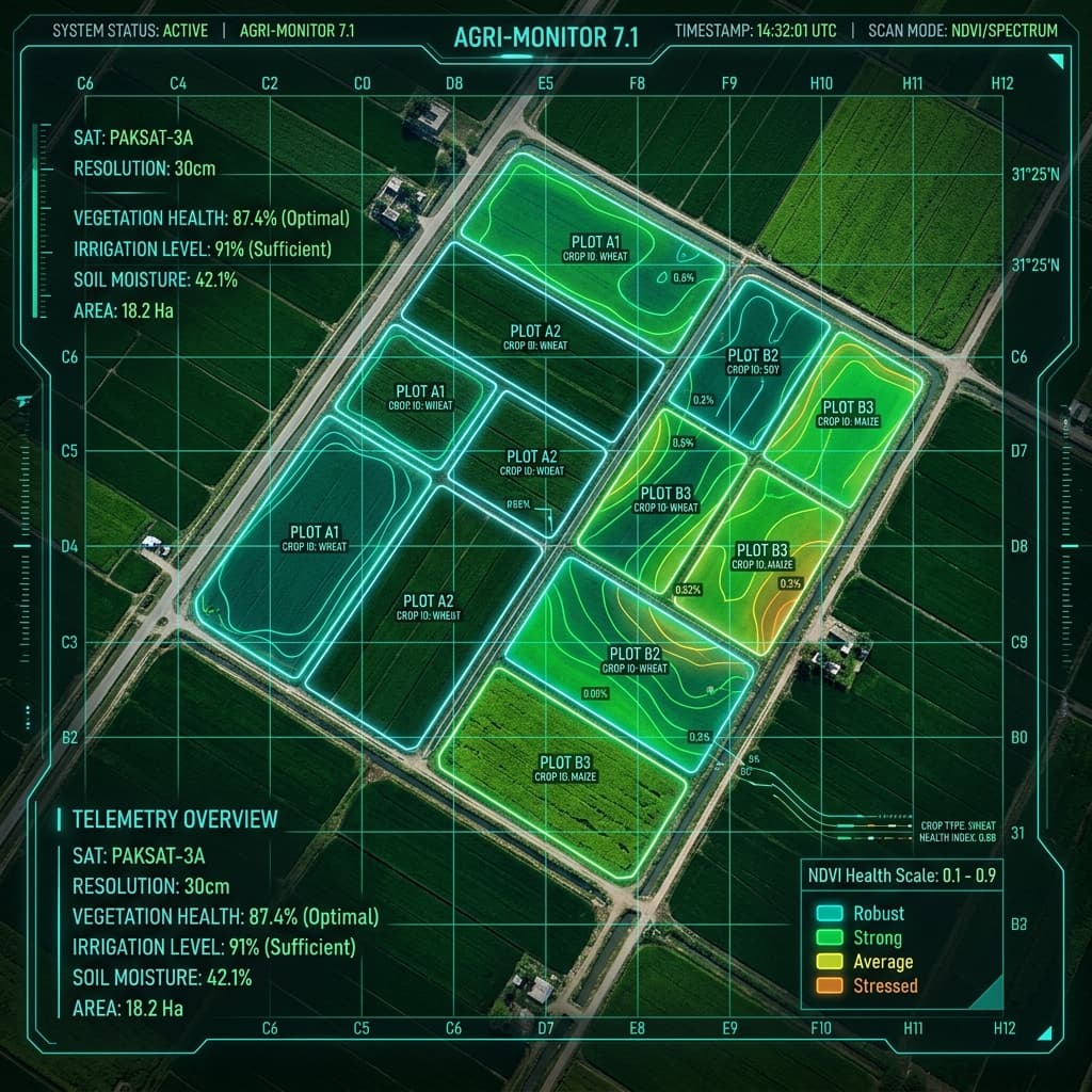
By processing Sentinel-2 spectral bands in real-time, we derive NDVI and NDRE indices to measure cellular leaf vigor. Instead of guessing, we compare current canopy performance against 5-year regional crop baselines to detect subtle decline weeks before it affects harvest tonnage.
- Daily checks of active Sentinel-2 scenes filtered for clouds
- Strict cloud masking via Sentinel Scene Classification (SCL)
- Automatic tracking of gradual stress onset (drought, soil salinity)
Hydrology, Inundation &
Flooding Markers
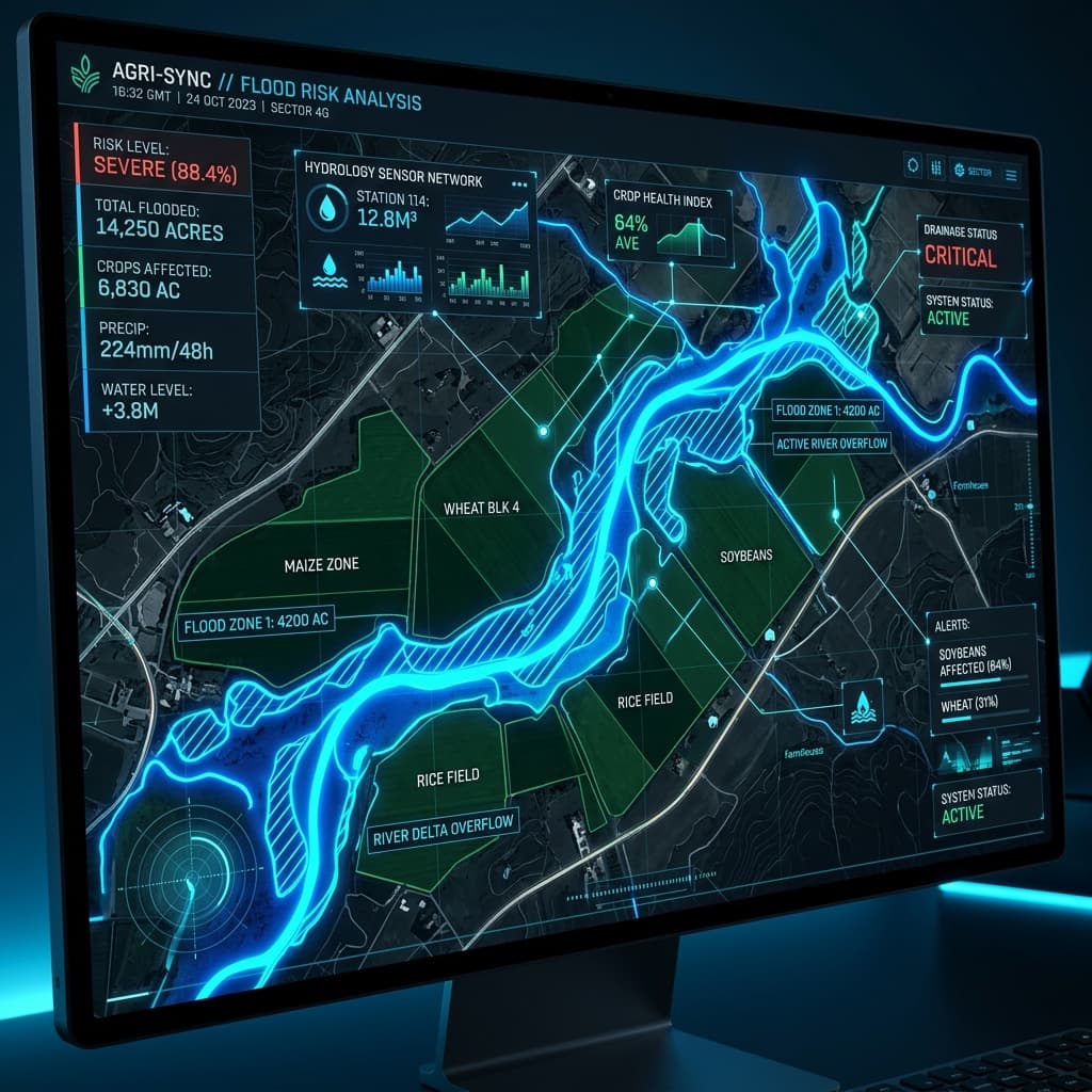
Acute water logging behaves differently than biological disease. We cross-analyze optical near-infrared moisture indices with Synthetic Aperture Radar (SAR) to map surface water penetration. This grants supply chains real-time tracking of flood zones, even through dense cloud cover.
- Radar-based penetrative sensing that bypasses cloud blocks
- Early warning on waterlogging and drainage failures
- Accurate acreage estimation of impacted farming zones
Ground-Truth Loop &
Model Calibration
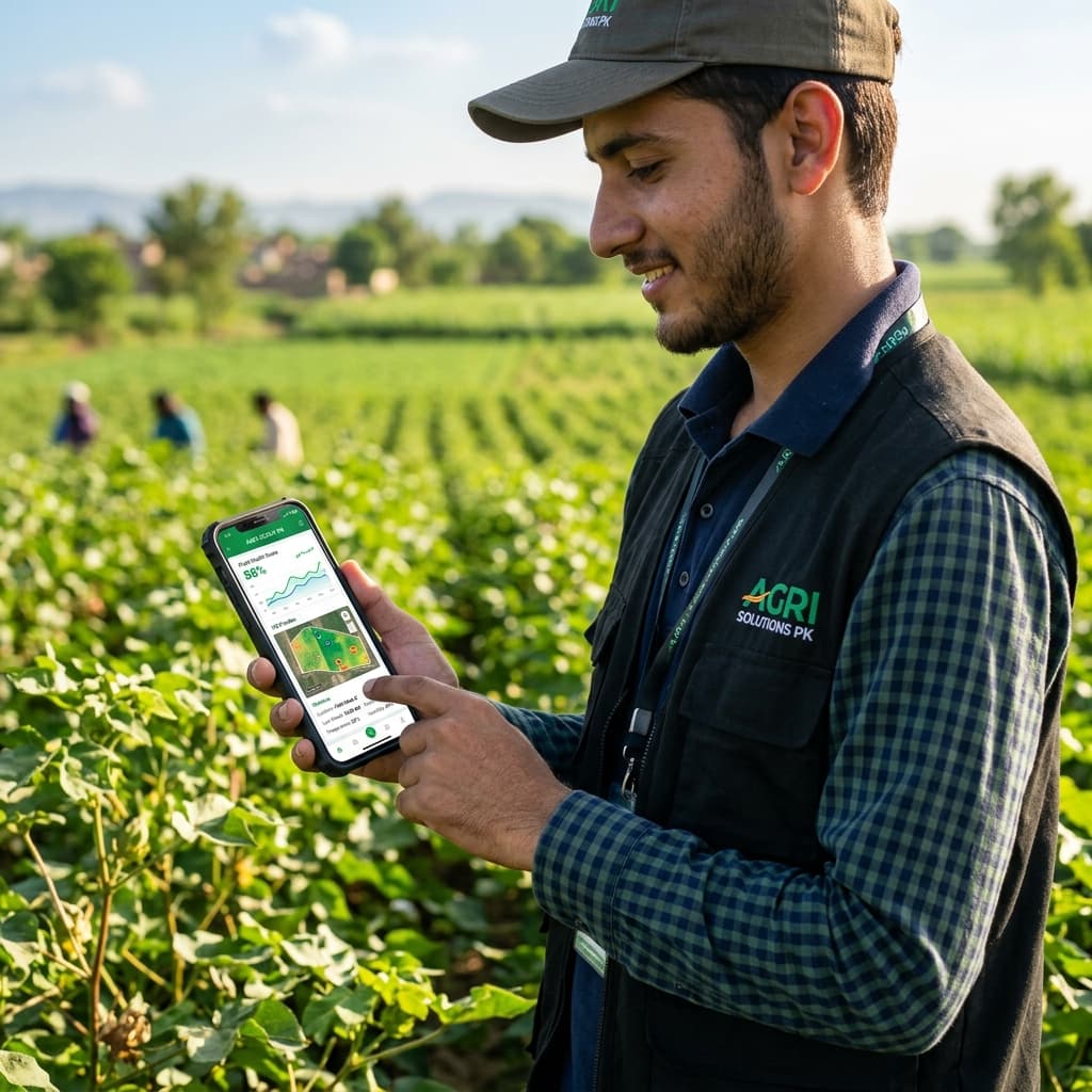
Satellites see anomalies, but people verify causes. Acreon closes the loop by connecting remote warning alerts directly with field scouts. When the system flags a sudden vigor drop, scouts are navigated straight to the coordinates to verify pests or deficiencies, updating our models in real-time.
- GPS-directed routing for field verification teams
- Dynamic calibration of Sentinel vegetation indices
- Consolidated risk reporting for corporate food buyers
Future Moat & Scaled Operations
Our advanced technology roadmap delivers high-barrier observation products designed for regional crop supply-chain forecasting.
Sourcing-Crop Classification &
Regional Mapping
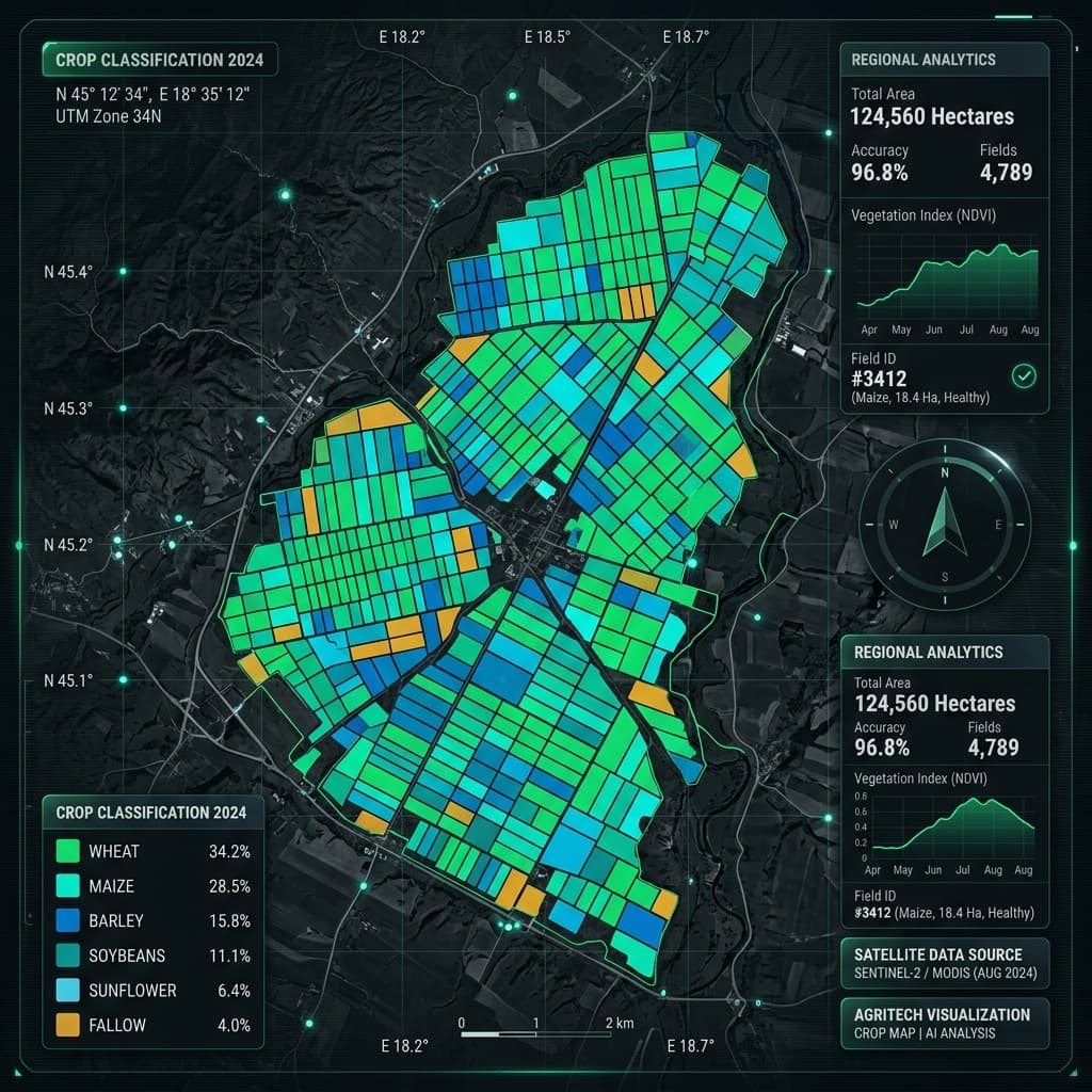
By modeling regional vegetation signatures across multiple satellite passes, our supervised deep learning algorithms identify exact crop boundaries automatically. This lets procurement teams map and monitor supplier fields at a district level without manual GPS tracking or drawing.
- Multi-temporal classification profiles that separate Paddy from other crops
- Automated field boundary delineation and acreage rollups
- Drastically simplifies onboarding for networks with thousands of growers
Crop-Stage & Phenology
Curve Alignment
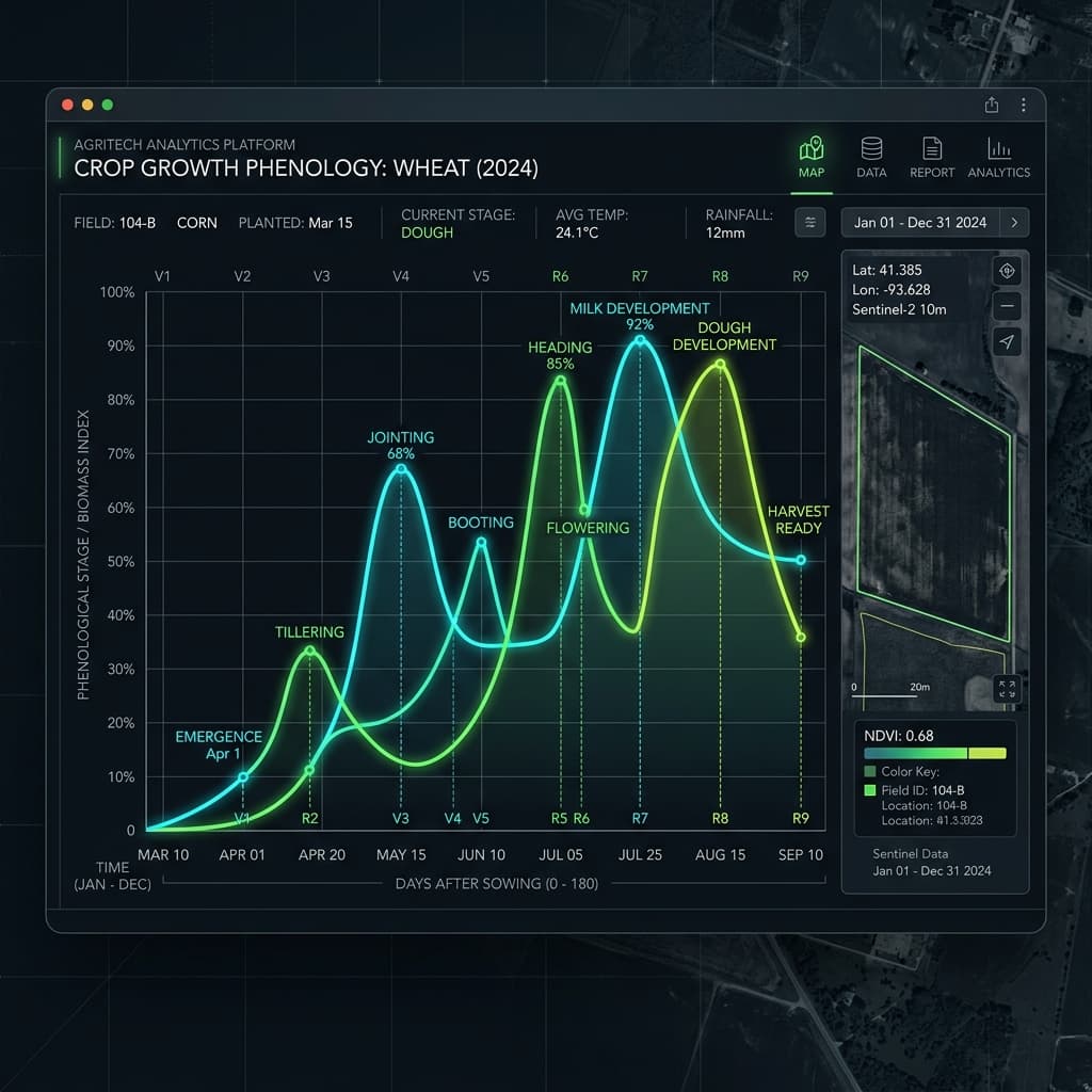
By tracking NDVI and chlorophyll index trajectories over the growth cycle, we detect crop development stages in real time. Our models automatically align local fields with expected phenological trajectories, making early-warning alerts context-aware.
- Detects sowing time, tillering, heading, flowering, and harvest windows
- Prevents false warnings during expected late-season crop dry-down
- Enables precise crop yield-risk alerts based on growth-stage delay
Harvest Progress &
Clearing Monitoring
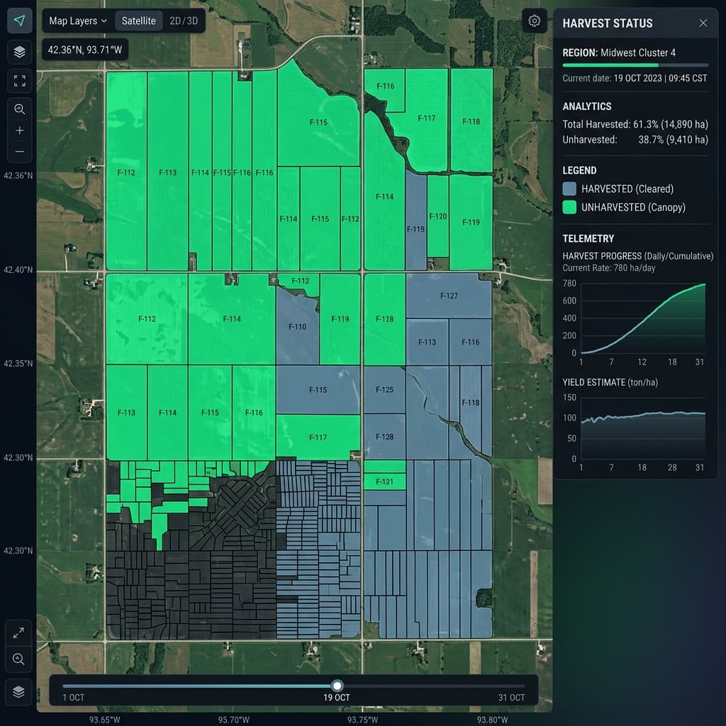
For processors and sugar or rice mills, coordinating harvest timelines is critical to prevent plant downtime. We detect harvest onset, track daily field clearing, and highlight delayed or stalled fields to streamline transport and crop processing schedules.
- Real-time monitoring of crop biomass clearing
- Minimizes costly waiting queues and logistics blockages at the mill
- Provides objective documentation of regional harvest volume trends
Securing Supply Chains Across All Tiers
From multinational food conglomerates to regional processing mills and smallholder scout networks, Acreon provides scaled observation products designed for every stakeholder in the agricultural value chain.
Supply-Risk Rollups
Monitor extensive regional sourcing networks spanning tens of thousands of hectares. Track multi-region risk rankings, map sourcing anomalies, and generate board-ready reports to secure global food pipelines.
Logistics & Mill Timing
Align milling, crushing, and storage schedules directly with satellite-derived harvest progress mapping. Receive early warning indicators of acute weather and flooding stress weeks before harvest tonnage is impacted.
GPS Verification Loop
Close the loop by directing field verification teams straight to anomalous coordinates. Empower local scouts to log outcomes on the ground, updating and dynamically calibrating our regional risk models.
Independent Verification
Verify regional planting zones, land usage, and crop stage classifications with objective satellite datasets. Ensure third-party ESG/MRV compliance without agronomic liability or prescription errors.
The Acreon Firewall
We draw a hard line between remote observation and absolute agronomy. While competitors promise uncalibrated prescriptions from space, we focus on high-fidelity risk signals and lead-time alerts.
"Vigor in the south block dropped 18% vs. last pass. Prioritize scouting."
"Apply 40 kg Nitrogen per hectare here."
Issuing absolute nitrogen or chemical rates from space carries massive legal liability. We leave agronomy to qualified local advisors.
"Stress anomaly detected in paddy field 04-A. Scout this area."
"This is an active fungal infection. Spray imidacloprid."
Satellites cannot tell the difference between aphids, fungus, or a broken irrigation pipe. We flag anomalies; your scouts verify.
"Biomass trajectory is tracking 3 weeks behind baseline. Yield risk: High."
"Expected yield is guaranteed to be 4.2 t/ha."
We supply risk signals and lead-time alerts to procurement teams, not absolute production numbers as crop promises.
See your fields from space.
Drop the coordinates for any growing region globally. Instantly generate a clean, honest health view of the portfolio without booking a sales call.
Validates coordinates → Pulls active Sentinel-2 scene → Renders clear-pixel NDVI baseline.